The Benton-MacKaye Trail (BMT) in beautiful North Georgia is named after the Massachusetts forester who had the original plan and dream for what is today known as the Appalachian Trail (AT). It is around 300 total miles long and takes about 20 days of continuous hiking to walk the entire trail. There are around 80 miles to hike in Georgia alone, with many day hiking opportunities that allow you to see parts of the Chattahoochee-Oconee National Forest that are rarely visited.
Take in the gorgeous views of mountains, wildlife, waterfalls, and forests of lush plants, trees, and wildflowers as you walk through these backcountry trails. The BMT has blazes with an off-white diamond symbol every 200 feet to keep you on track. The trail begins at Springer Mountain in Georgia and continues to the summit of Mt. Sterling as it passes through Tennessee and North Carolina as well, ending at the Davenport Gap which is at the northern edge of the Great Smoky Mountains National Park.
Long-distance hikers may wish to take some longer trails to more remote wilderness areas, or even thru-hike the entire trail. Be sure to plan ahead, resupply, and leave no trace as you hike. BMTA.org is a great resource to help with planning before your hike.
Day Hiking Trails
Long Creek Falls Trail – Toccoa Suspension Bridge
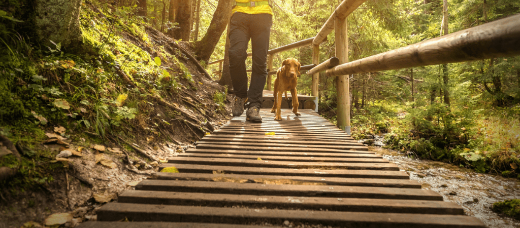
The Long Creek Falls hike is a popular section of the BMT where you can take the entire family and your furry friends on leashes for a wonderful day hike. As you hike this easy, 2-mile section of the trail, you hear the water rushing over rocks along the big creek and witness the bountiful, beautiful plants and flowers this water source nourishes along the way. The path to the falls is just past the intersection where the AT and BMT take their separate routes. A perfect picnic spot is just 100 yards up the side trail to the left.
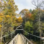
For those wanting a little more of a challenge and a longer hike, this stretch of trail continues another 7.8 miles and takes you to the incredible Toccoa River Suspension Bridge. This bridge is the longest swinging bridge east of the Mississippi River spanning 260 feet over the Toccoa River near Blue Ridge, Georgia. If you have kids and want to walk on the bridge, there is a 3-mile unpaved road you can drive before walking a short distance to the bridge.
Fall Branch Falls Trail
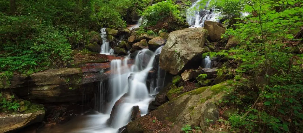
The double waterfall is less than a mile from the parking area along Stanley Creek road near the booth for the trailhead located in Cherry Log, GA. It is an easy, family-friendly hike where you can let your dog walk and enjoy the rhododendron and mountain laurel growing all along the banks of the falls. The hike will take about 30 minutes round trip and is an easy hike for young and old.
Springer Mountain to Three Forks
Pack a lunch and a leash for your furry friends along this 6.1-mile section of Benton-MacKaye Trail. Springer Mountain is where the BMT shares its southern terminus with the AT. The hike is rated an intermediate to difficult hike with a beautiful spot to rest, picnic, and take in the overwhelming beauty of the surrounding mountain ranges at Owen’s Vista only 1.3 miles in.
Remember the leave no trace philosophy and make sure to respect nature and take all of your picnic trash with you. Owen’s Vista is a south-facing shady bluff named after one of Benton MacKaye Trail Association’s founders, George Owen, who first noticed this breathtaking view. A little further down the trail, you pass a dry gully and a few streams as you go the next few miles and end up at Three Forks to finish the hike.
Rhodes Wallalah Trail
Another long-distance trail for backpacking is the 6.2-mile hike that takes you to 2 beautiful lookouts along this Appalachian Mountain range. Hikers enjoy the spectacular, panoramic views they get to witness from the summits of Wallalah Mountain and Rhodes Mountain on this trail. This section of the BMT is difficult with the footpath taking you uphill to a steep vista just below the summit of Wallalah and gives you a picturesque view of the Tooni Mountain ridgeline, the John Dick peaks, and the ridge that houses the Blue Ridge front ranges Appalachian Trail Route.
Fontana Dam – Lakeshore Trail
Fontana Lake is over 10,000 acres, made from the installation of the Fontana Dam. The dam is 2,365 feet long and 480 tall which makes it the tallest in the eastern United States. The hike begins as the BMT and the AT cross Fontana Dam and enter the Great Smoky Mountains National Park where you may come across some thru-hikers hiking the AT from end to end. It is a fairly easy to moderate hike for the family, but remember – dogs aren’t allowed in the park.
Lakeshore trail has lots of history and was once home to villages for the Cherokees and later logging campsites before the dam was built. The entire trail is 35 miles long, so just go as far as you want and enjoy all of the gorgeous landscape along the way. If you plan to hike long distances, make sure to check resupply locations and use shuttles if necessary.
Jacks River Trail – Penitentiary Trail
Jacks River Trail is a 6.8-mile trail that follows the ridgeline and opens up magnificent views on either side. Jacks River Trail continues on to Hemp Top Trail on its way to Big Frog Mountain. The Hemp Top Trail is a horse trail that this section of the hike follows; make sure you watch for riders and be courteous if you cross their path.
Penitentiary Trail is the next section. It was at one time a logging camp road and was so remote it was given the nickname “The Penitentiary” and was not popular with the loggers. The last section is a steep incline to Big Frog Mountain and the beauty that awaits.